330 river miles, 10 land miles, 6 dam portages, 3 storms, 2 illegal camping spots and 1 broken tooth.
Photo style: Sunny and bright, overexposed, pulled up shadows to match the vibes of the river and the southwest.
Intro:
In the heart of the American Southwest lies a spectacular feat of engineering, the iconic Hoover Dam. As its imposing walls hold back the mighty Colorado River, it also serves as a gateway to an adventure that few have ever attempted. In fact, I have only seen count of 4 other people doing this. Not only that, but I also can’t find tale of anybody doing it totally unsupported like we did! Or in the time frame we did it in, closest we saw was 16 days, world record maybe?! Idk if I care enough to look into honestly.
Equipped with determination and a passion for exploration, I started planning a journey that would take us from the Hoover Dam to the sun-kissed town of Yuma, Arizona.
Planning:
Our first step was getting the logistics down, how to get permission to launch at the Hoover Dam? How many days do we need? How many Dam portages and how to navigate them? How do we get back to our vehicle? What time of year should we do this?
Scraping the internet, I saw 16 days to be the shortest time. We landed on just shy of three weeks to make sure we could account for bad weather or any other variables to make it successfully.
For putting in at the Hoover Dam, it actually requires a special permit that is only issued via local outfitters. No civilian can acquire permission on their own, so an outfitter was our only option. We landed on Desert Adventures based out of Boulder City, NV.
The ride situation worked itself out rather elegantly, my parents were talking to me about visiting lake Havasu and checking out properties down that way. We ended up just lining our plans up so they could be in the area around the same time.
As for time of year, we decided it was better not to melt our faces off and do this in February. Which being from Salt Lake City, meant that we were leaving here in the heart of winter. No skin off my back.
February 12th, 2022. We left SLC and began driving towards Vegas.
Day 1: Feb 13th
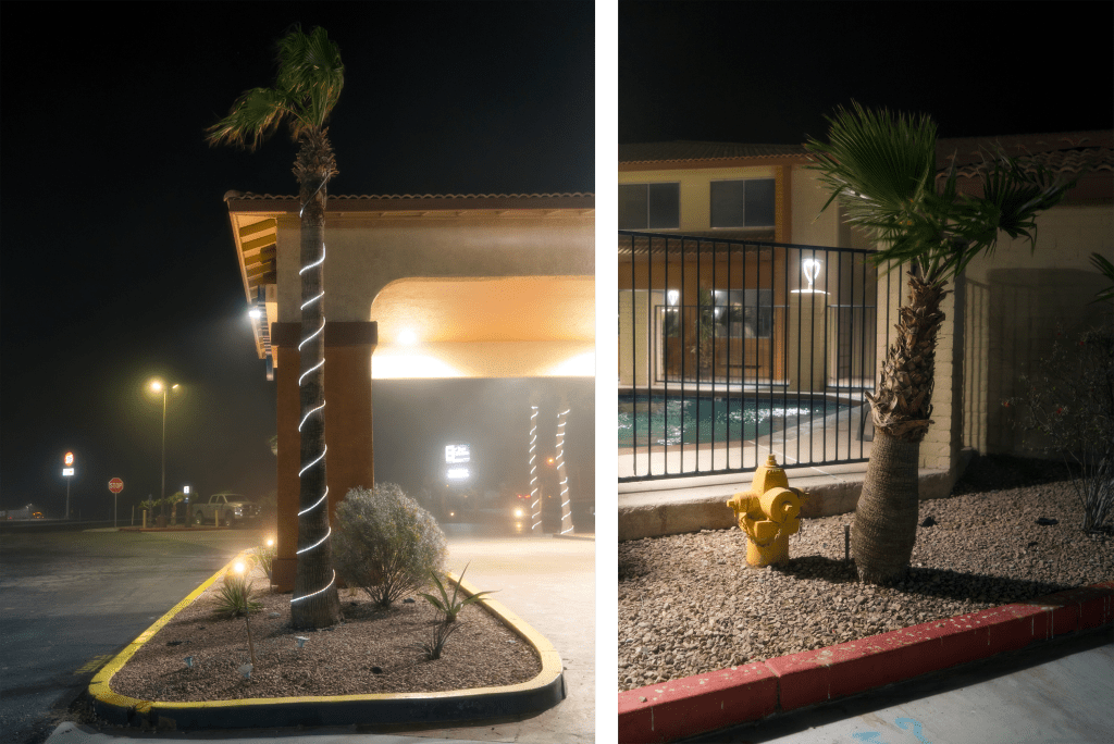
After sleeping in the parking lot of the Hoover Dam Lodge and Casino, we stepped inside to speak to management about leaving my truck in the parking lot for upwards of 2 weeks. Luckily, we were able to track down the right person and head of security was insanely nice and helpful, we left them a nice tip for being so rad.
7AM rolls around and the outfitters met us in the parking lot as promised, along with the other people who were going to be day paddling from the dam to the first exit point. We unloaded our kayaks and all our gear and put it with the outfitter’s kayaks on the trailer. As the only ones with our own kayaks and a hefty bit more gear than everyone else, the questions started flying.
“Thats a lot of gear for a day”
We laughed and joked with everyone as we made our way down the heavily secure private access road to the base of the Hoover Dam. Once they heard our plans, they were met with uncertainty, doubt, words of encouragement and various other comments, all in all though, it was certainly fun seeing the different reactions.
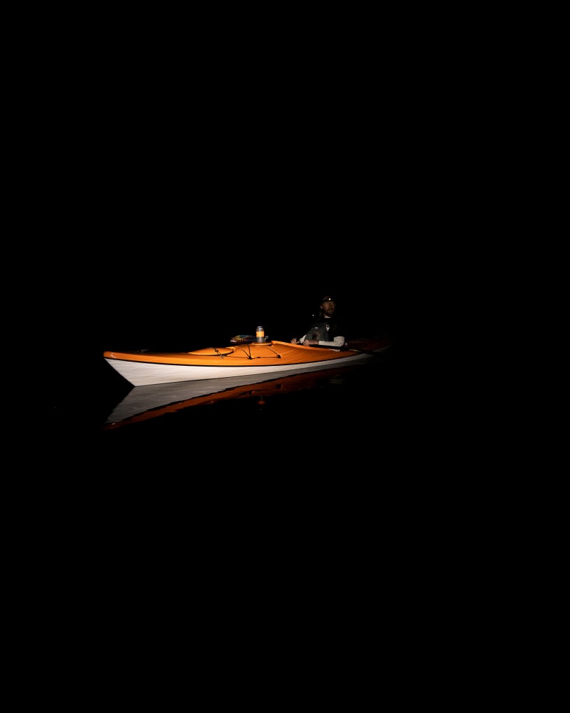
Unloaded and out of the van, we gathered our things and began hauling them down to the rocky shores below the dam. Dam security hovering over us, watching us load up and trying to rush us out of there. Yelling at us that we were taking too much time, only 10 minutes for reference ha! Clearly unbothered as we took some photos to commemorate the start of the trip.
We hopped into our kayaks, cracked some beers and before heading down river, I proceeded to take photos of the gigantic Hoover Dam while still being yelled at by the security guard that we needed to get moving.
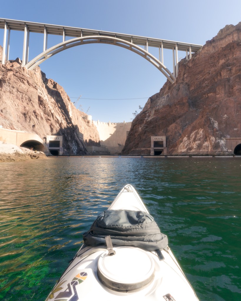
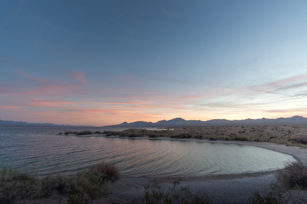
Turning around, pointing our kayaks down river, we lazily let the current take us as we finished our starting beers. It was 9:30AM and we had just sealed the deal on our commitment to keep paddling 340 miles to Yuma AZ. What did we just sign up for?
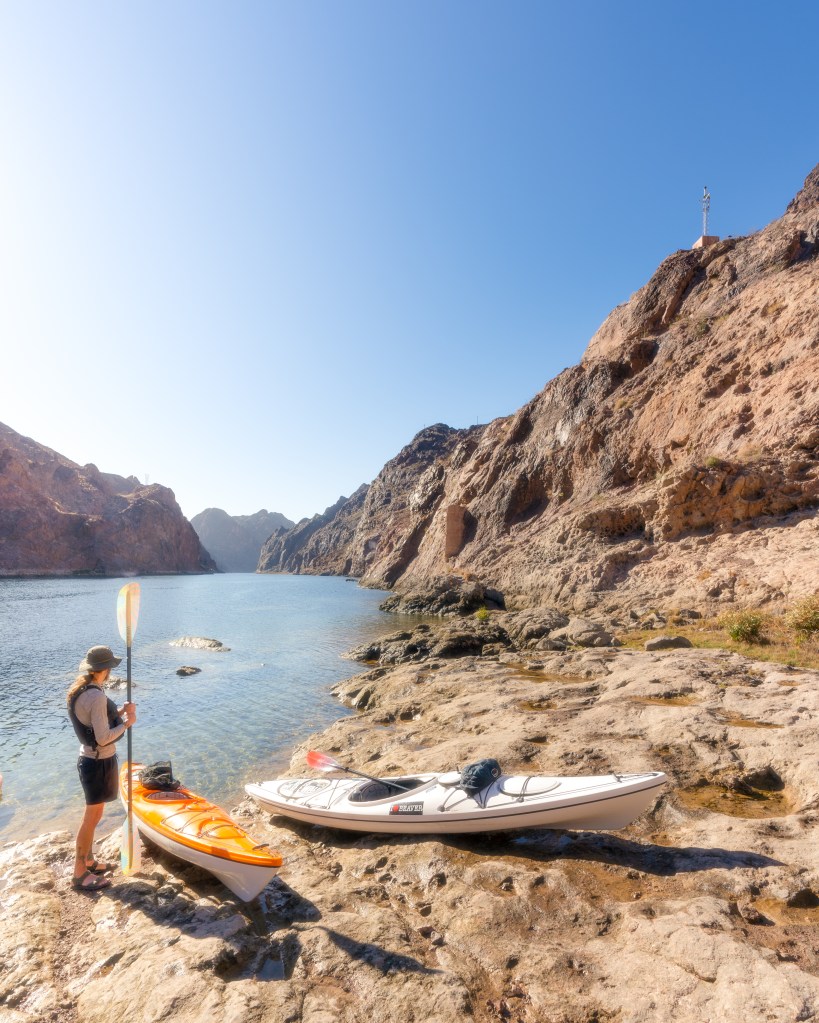
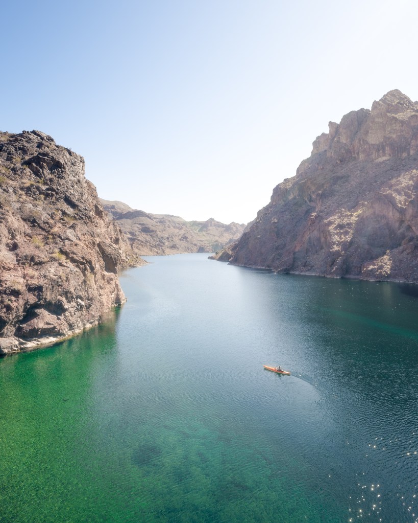
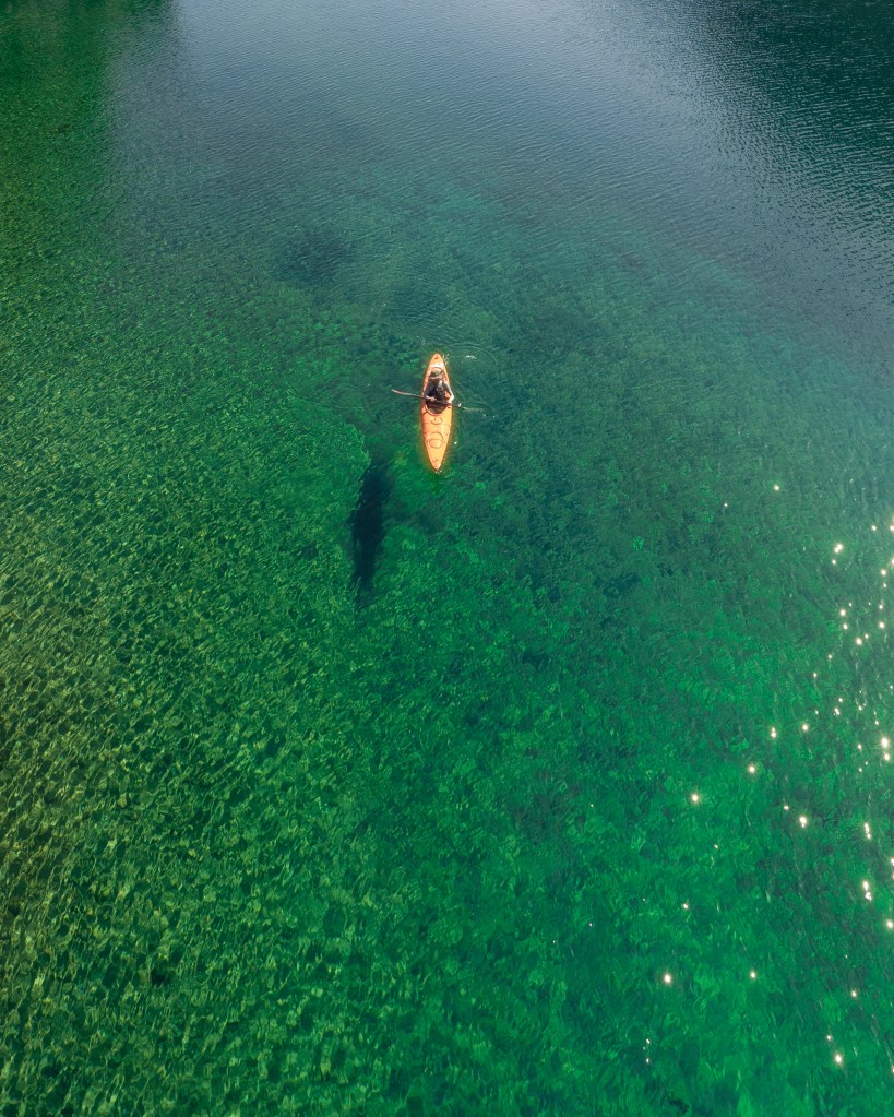
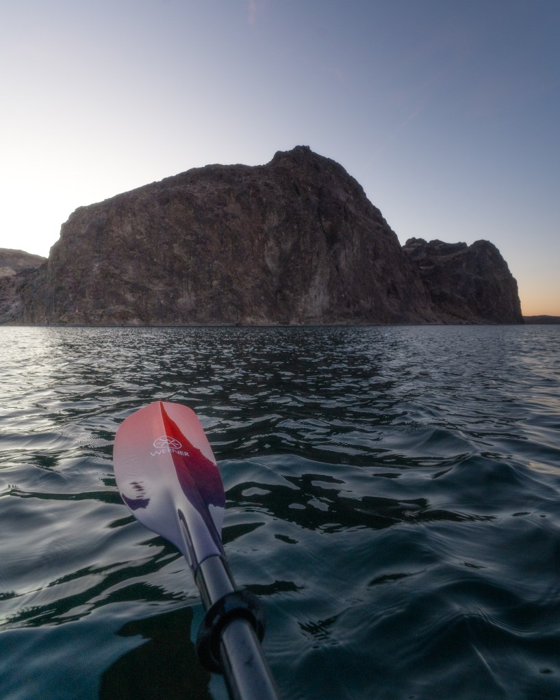
This first section of river is insanely popular and for good reason. It is absolutely gorgeous and within close proximity to Vegas, so it sees some traffic! All that aside, I definitely recommend checking it out. Huge canyon walls, some caves and pools of emerald water make it worth seeing.
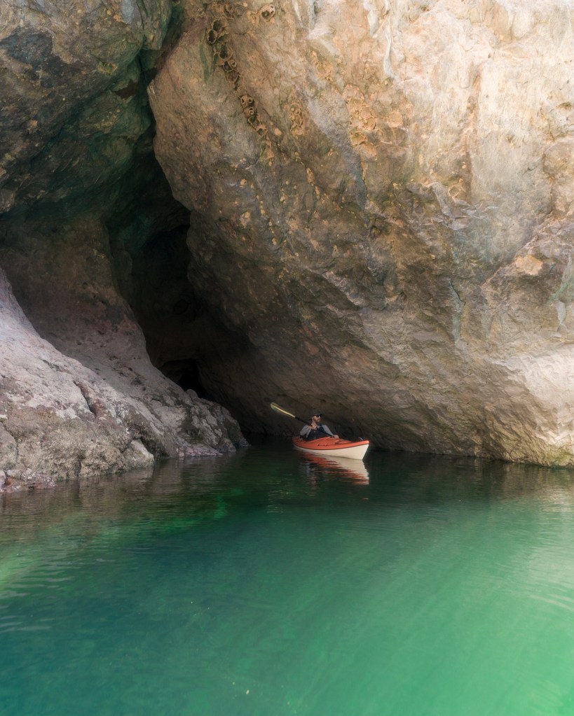
We took our time through this section and made sure to enjoy it. Not our first rodeo through this section. There is a spot I always like to get out and take a bird’s eye view photo of a friend for scale.
After some fun, we pressed on knowing that we had to make some distance.
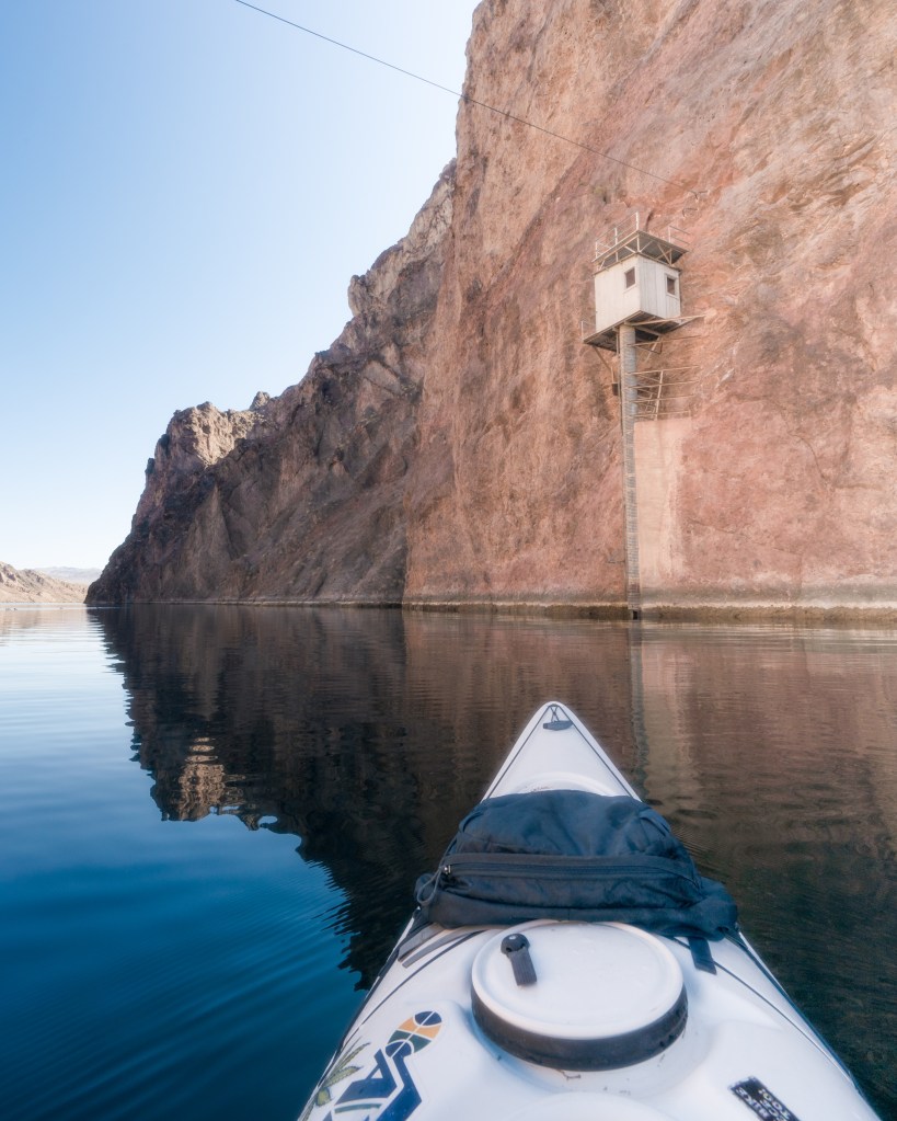
The next fun feature is this old river gauging station, sitting high above the water line of the Colorado. The old river gauger had a house about a half mile further down the river, they would have to take a goat trail up the canyon before getting cliffed out and following a trail built on wooden planks along the cliff. From there, they would get in a basket hanging from a wire and pull themselves across a small channel back onto the literal cliffside trail. Then they get to one last basket and wire, were they cross the main body of the river to this river gauging station. The remains of the house, the cliffside trail, baskets and wires all still visible.
Talk about a commute!
After enjoying the Black Canyon section, we pushed forward and started really laying down the miles. We made it to about mile ~28 around 5PM and we were starting to lose light, we found a nice spot to set up camp for the night.
Day 2: Feb 14th
A wild hair up our ass, we decided to hit the river at 6AM in the pitch black. Why? Who knows but it was certainly fun! And we do NOT recommend doing this as it would almost certainly spell hypothermia if something were to happen. Water is 53 degrees year-round while outside temp was about 40 degrees.
We enjoyed a beer as we floated down the river waiting for the sun to pop up over the horizon.
After a few hours on the water, we pulled into a small eddy to snack up. Peanut M&Ms and some jerky were on my menu, after a few mouthfuls, disaster struck; I bit down and next thing I knew I was in searing pain. My crown had broke, (not knowing how bad it was at the time) cracking what was left of my tooth all the way down the root. My mouth and face swelled up and I couldn’t eat anything the rest of the day.
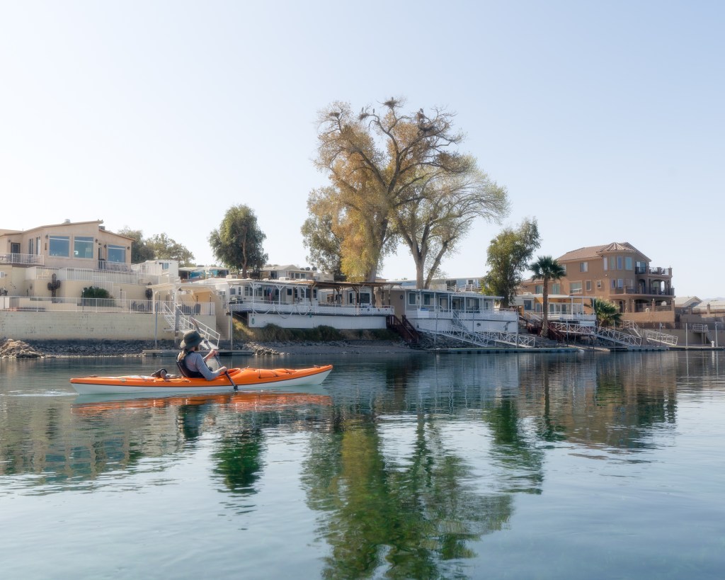
We pressed on, battling a slight headwind until we reached the top of lake Mohave. At this point the river really opens up, becoming a lake up to 4 miles wide. The winds are pretty notorious here and by mid-afternoon they start blowing north, making for some slow progress.
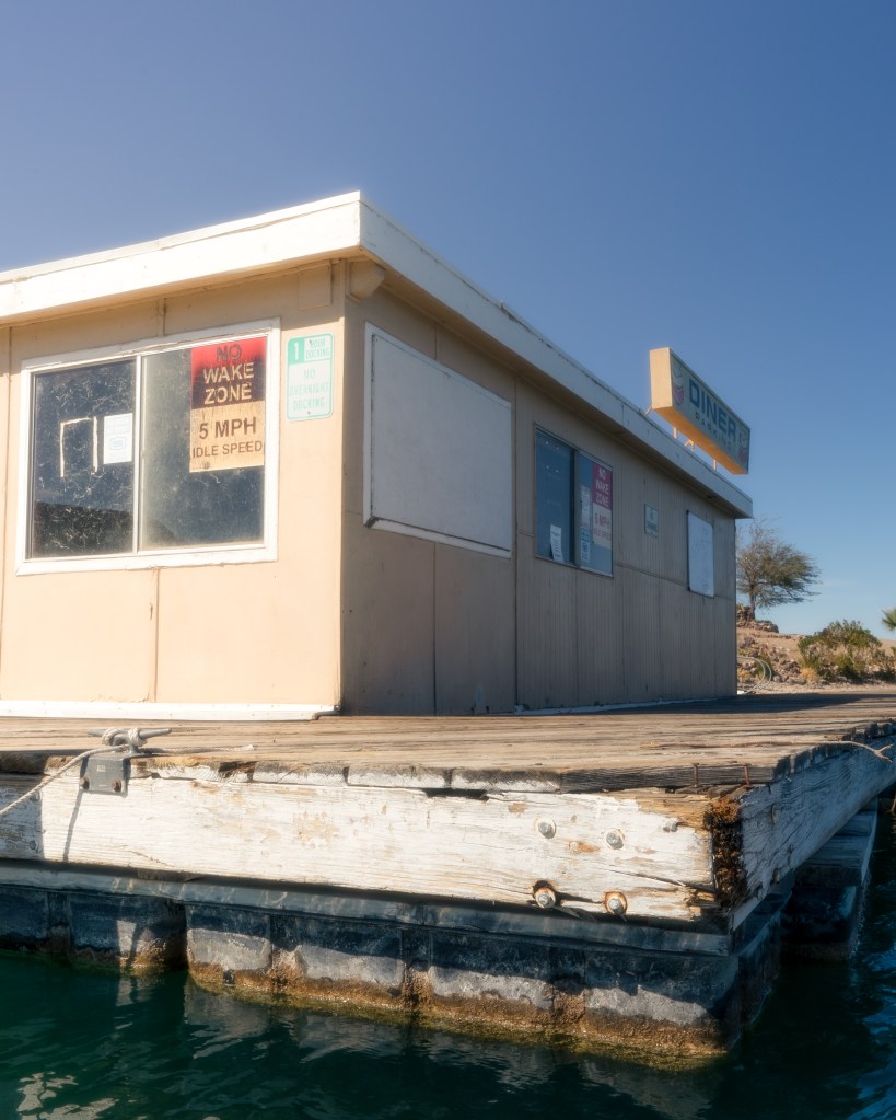
There’s a small marina at the top of lake Mohave, we paddled in to see if maybe there was a restaurant or anything worth checking out. I was hoping for a dentist office but no luck.
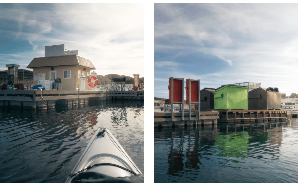
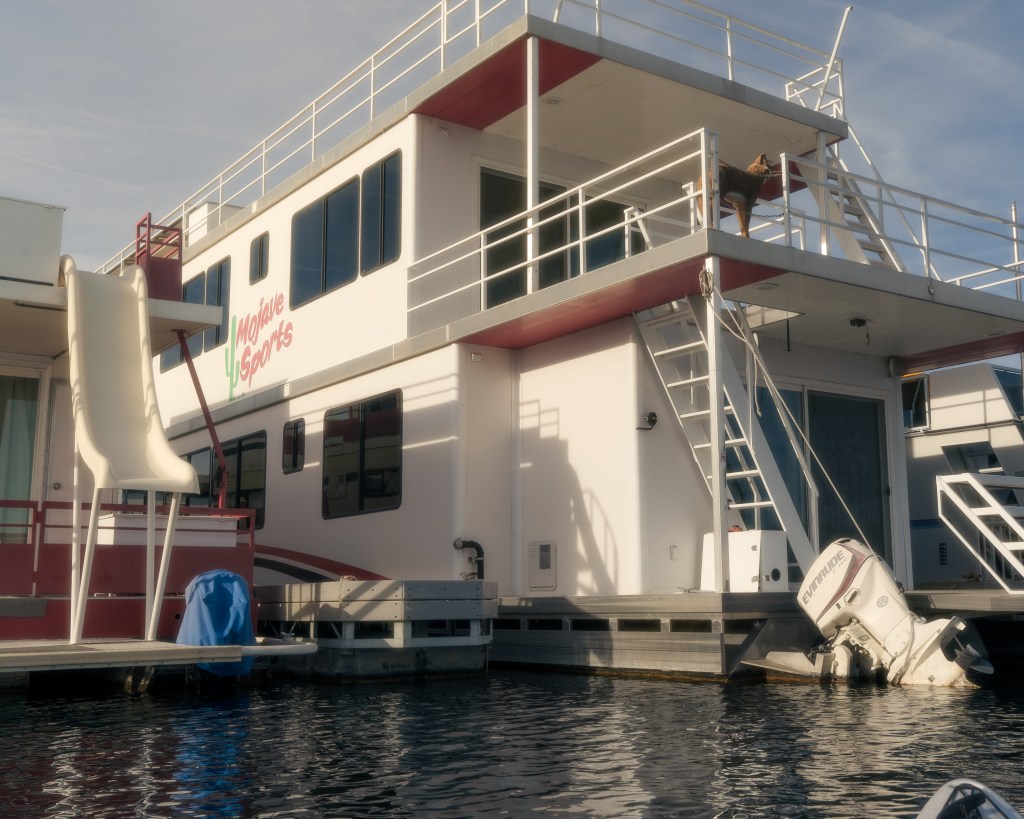
I’m sure in the summer months it is much more bustling, but it was relatively dead while we were there. I took the opportunity to take a few photos of the docks and house boats before moving onward to find our next camp.
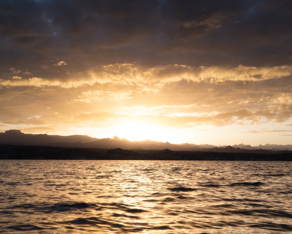
We found a place to set up camp just around the corner from the marina, after setting up and watched a great sunset. Completing about the same amount of mileage as day one.
Day 3: Feb 15th
Today the wind was a real problem, I mean a real problem. We had some bad weather hitting us, rain, heavy head winds and 5-foot waves halting our progress. We were getting hammered by waves, which was both freezing and unsettling. At this point we pulled over after only making it a few miles, trying to wait it out. We caught a small break, so we continued on.
It didn’t last long, only about 20 minutes before it started back up. The only way we could keep going was by hugging the shore as tight as possible where the waves were slightly smaller and we were a little more sheltered from the wind. It was slowwww going at this rate, a miserable day so far.
After working 10 times harder and going a fraction of the distance, the weather let up a bit with a few hours of sunlight left, we pushed to find a camp spot.
A Short while later, after a few unsuccessful side canyons looking for a camp spot; we finally found one. Excited and beat up, we set up camp and almost immediately passed out. Only about 8 miles today.
Day 4: Feb 16th
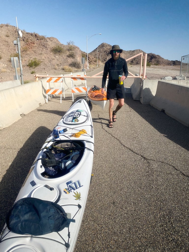
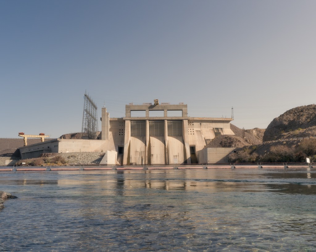
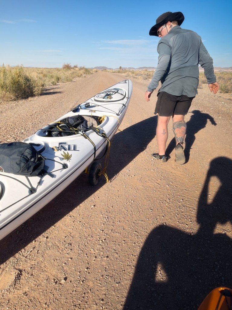
Once again, we got on the water before the sun as we felt like we didn’t make enough distance the day before and we also had our first dam portage to deal with.
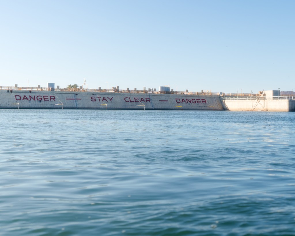
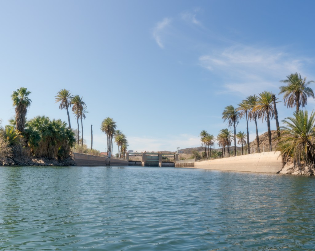
After a much more peaceful and mellow few miles, we finally made it the Davis Dam and have completed our first 70 miles of river. Figuring out where to legally get out and get ready for our portage was the first challenge.
We ended up getting out on the west side of dam, there was a bank of rocks with a small chain at the top. I fumbled around to get out while Brian held my kayak in place so it wouldn’t go anywhere and scoped things out. It looked like it would work for us!
We got the gear out of the kayaks and managed to pull them up and over the chain. From there we busted out our little cart caddies, got them assembled and the kayaks reloaded and on top of the caddy.
From there it was about a mile walk through a construction zone and a little park at the base of the dam, we drank Twisted Teas laughing our way to the water at the thought of taking our kayaks for a walk.
Just before making it to our put in spot, Brian lost a wheel. So, we back tracked looking for the pin that keeps it on the axel. No luck. Using paracord and carabiners we jimmy-rigged it to make it happen.
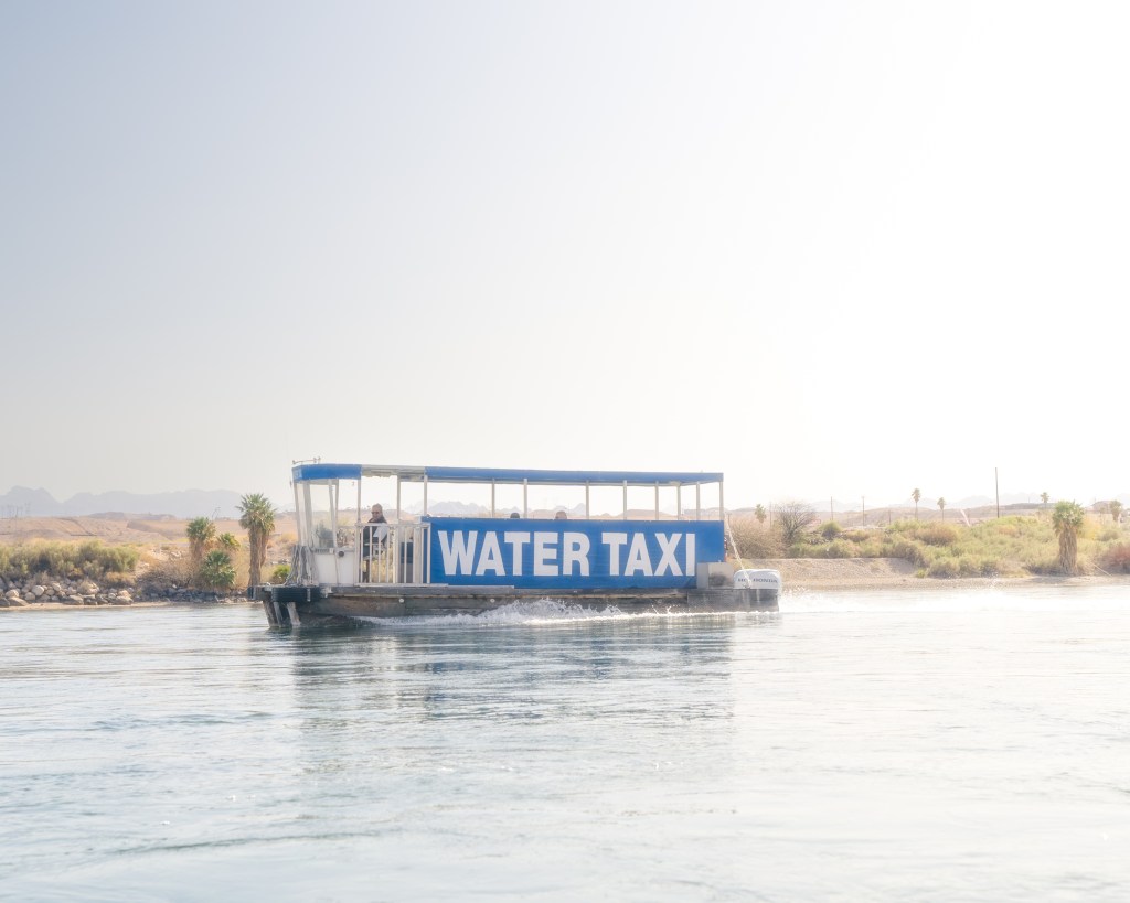
We made it to our put in where there are warning signs due to the current after the dam. Once we put in, our kayaks were turned into rocket ships and we blasted down towards Laughlin. This ended up being one of the coolest sections, despite the lack of nature.
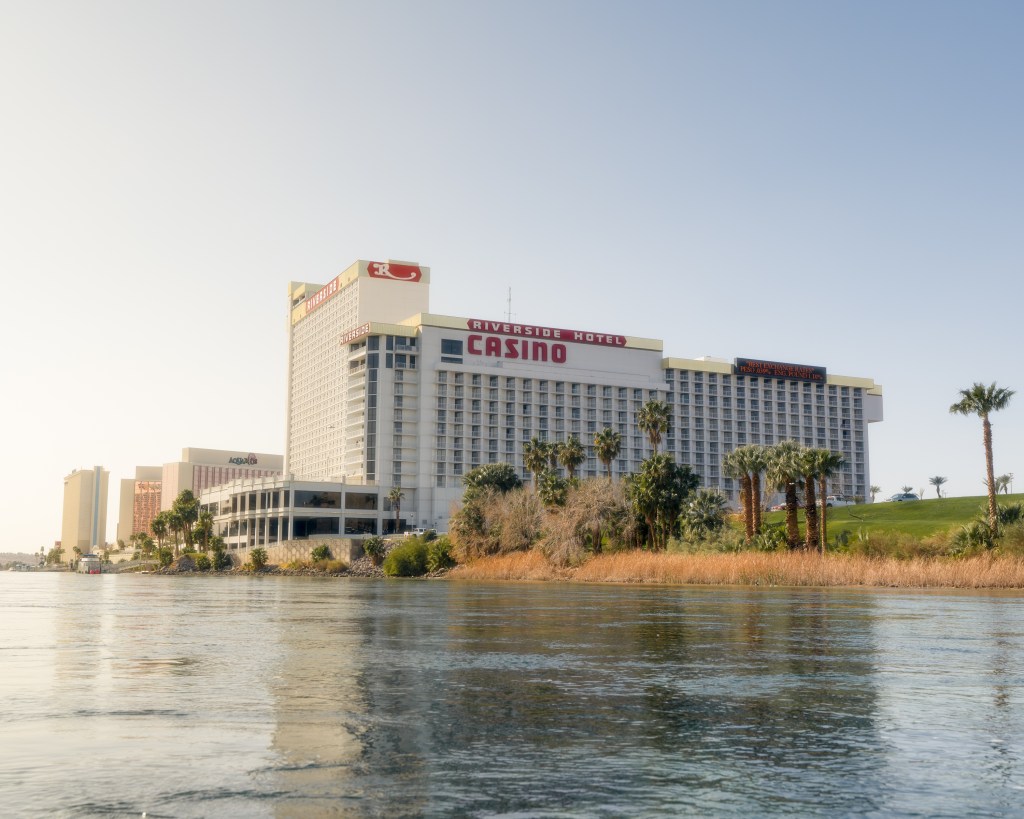

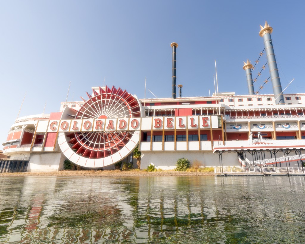
Passing by the casinos and water taxis taking people back and forth across the river made for a really interesting experience. We had a few people yell to us from the casinos and we yelled back. They didn’t believe us when we told them we were heading to Mexico!
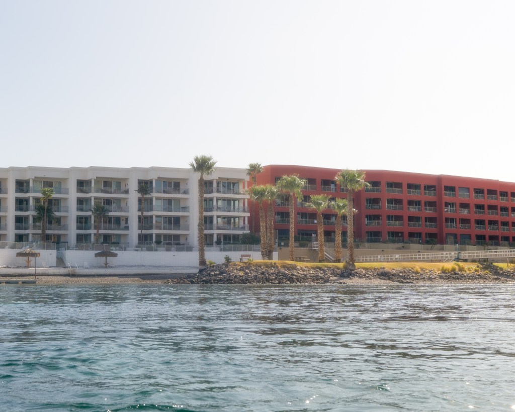
A little bit after passing the casinos, we started hitting the suburbs along the Colorado. Which was also interesting, passing people sitting on their private docks, slowly getting further and further from civilization again.
This ended up being a long day, we paddled ~37 miles before calling it day near Needles, CA. We found a small RV park that was off the river. After pulling our kayaks up onto the grassy hill, we found somebody to help us and we paid for a tent spot.
Myself, who has been surviving off the little bit of soft foods I had in order to save myself from as much pain as possible; wanted some real food and I didn’t care about the pain. We marched into town and found the holiest of holy, Jack in the Box. About a 3 mile walk round trip.
After gorging on some Jack, we walked back to camp and passed out, ready to head into another gorgeous section of river that Brian and I have done in the past.
Day 5: Feb 17th
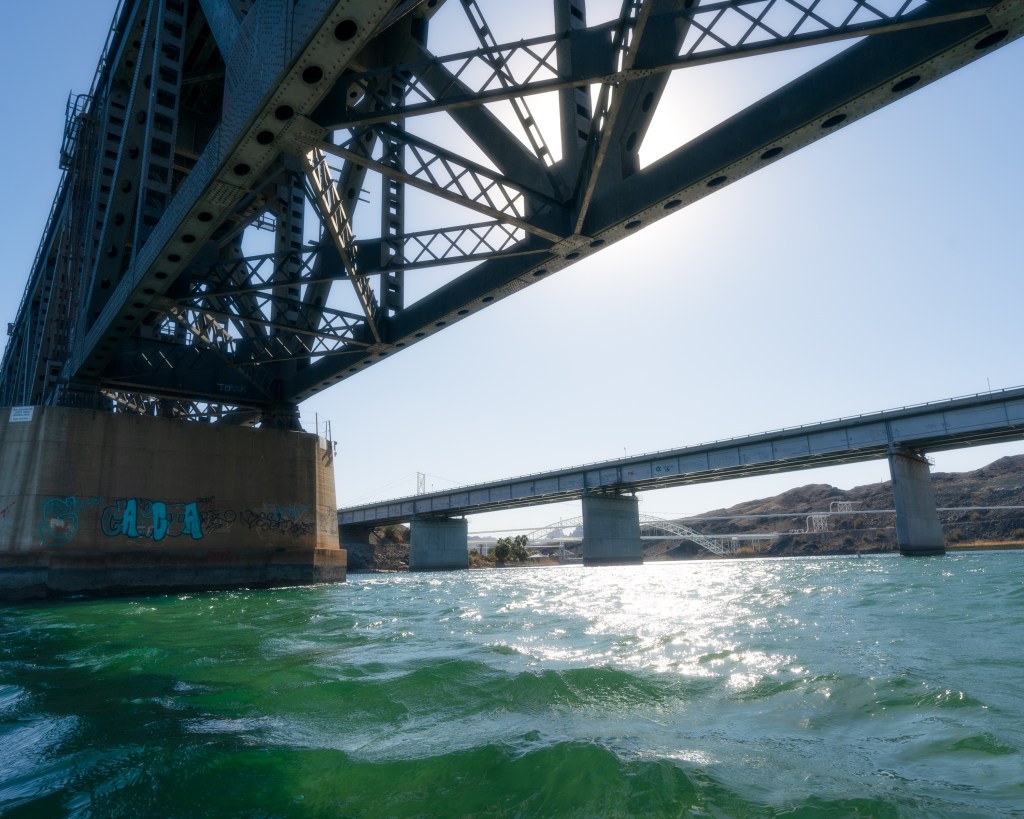
Packed up early and wheeled our kayaks down to the water and shoved off, realizing at this point that we had done our first 100 miles. Feeling good about the day to come, we paddled fast to get to Topock Gorge. This is another section of river that I would recommend checking out if ever in the area.
A few hours go by and finally we come to some familiar bridges marking the beginning of Topock Gorge. Which unlike the bridges and man-made structures we have been paddling passed the last few days, it is a natural and wildlife refuge.
The current really starts to pick up here along with the scenery, so we slow our pace and let the river do most of the work. Pulling over on a nice beach for a stretch and a view.

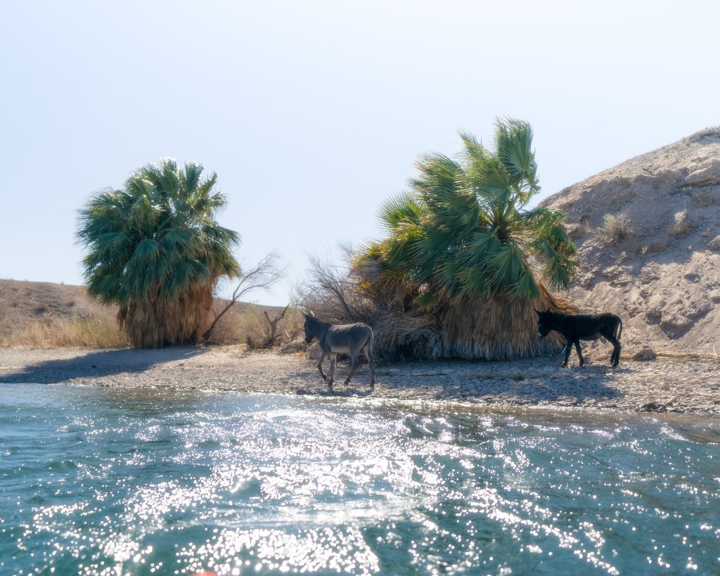
The Needles start to come into view, which is what the city of Needles, CA is named after. Ironically though, they are in Arizona. As we get a little further, we can hear the sounds of Wild Burro’s HEE-HAa’n. Which are both hilarious and unmistakable.
It’s still relatively early and we were entering Lake Havasu. As it opens up there is a giant sand bar which made for an interesting bit of paddling. When the 2-3 foot waves we were dealing with at the time would come, it would suck the water and make it shallow enough to rub bellies against the sand, and almost tip you if you weren’t fighting to keep the bow facing down river.
The infamous London Bridge was our next goal. Yes, the real London Bridge. Some rich American guy bought the thing in 1968, broke it down and had it rebuilt in AZ on Lake Havasu brick by brick. A ridiculous endeavor indeed, so obviously I wanted to see it.
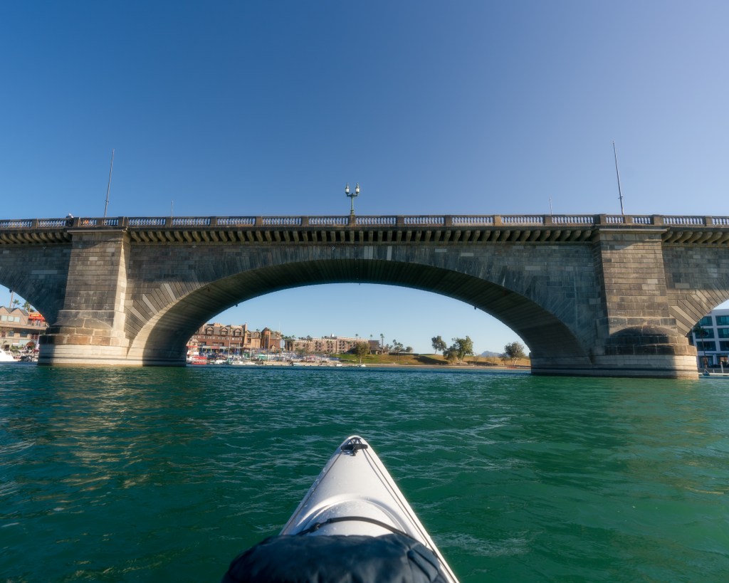
Nowhere to camp or stay cheap here so we don’t bother getting out, just paddle through and keep on going.
About a mile or so later, we found a little pay to stay primitive spot for boat up camping. Totaling about ~37 miles again, like the day before. After setting up camp, my searing jaw was ready for an adventure into town for Orajel, more ibuprofen, soft foods and a solid beer resupply. It was already dark but it looked doable on the map, so we set off.
We bushed it until we hit a road, then followed the road to State Highway 95, from there we made it to a gas station where I got everything I needed. After gobbling a few glizzy’s down and paper-bagging a beer in the parking lot, we began our hike back to camp, resupplied and re-energized. Well worth the 3 or so miles round trip, fun stretching the legs a bit too!
Day 6: Feb 18th
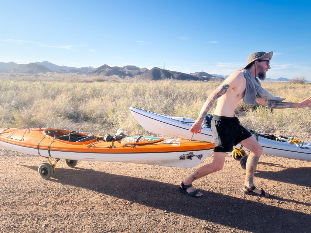
As we got further and further from camp in the morning, Lake Havasu starts to get narrower and more scenic again. Today’s goal is the Parker Dam portage and try to find a place to stay above the famous Parker Strip, where everybody just parties all day.
By about 4:00PM we made it to the Dam, this portage was going to be an unknown distance, as we were unsure of where we were going to be able to put in on the other side. Got our kayaks up the boat ramp by the dam and up into the parking lot, where we enjoyed a beer and some snacks.
At this point realizing I had suffered the same fate as Brian and had also somehow lost a pin to keep the wheel on the axel of my kayak caddie. So now I am also jimmy-rigging mine.
A steep quarter mile incline to the top of the dam, then back over the other side and into the small town where everything river front is private property. Great. We didn’t have service and we walked aimlessly through town trying to find a public access to the river. Finally, we decided to find some nice folks who were outside their home and plead with them to let us use their boat ramp.
The nice people wrangled the homeowner and after hearing of our tale so far, kindly obliged us. We had done it, our second dam portage. Only 4 more to go! In a rush, racing the sun and searching for a place to call home for night; we sent off down river.
A few fast miles later and we were passing a nice-looking campground / RV park called Buckskin Campground. We pulled the kayaks up, went to the entrance and nobody was there, they had already left for the day. Unbothered and determined to sleep there, we found one of the open tent spots and started setting up.
The signs and directions for what to do when nobody was present, plus the reservations, lack of vehicle and how much to pay where all a bit confusing for our situation. We stuck some money in an envelope and figured we could talk to a ranger in the morning if they showed up. Also, the camper next to us had already offered up some space, if for some reason somebody came to claim the spot.
Discovering the free hot showers conveniently located by our tents, we drank some shower beers and just relaxed. Total river miles for the day were ~21 and walking our kayaks along the highway was close to 2.
Day 7: Feb 19th
Took our time getting out of there in the morning, there was a boat up bar / restaurant calling our name that didn’t open until 10AM. Before we could leave though, the ranger did show up and helped make sure we were situated, she was very nice. Overall, we loved camping there and our neighbors were fun.
Foxes floating bar came into view a short while after leaving camp. We got a few drinks and some breakfast burritos before continuing on the Parker Strip. The next big obstacle, Headgate Rock Dam came into view around 1:00 or 2:00PM.
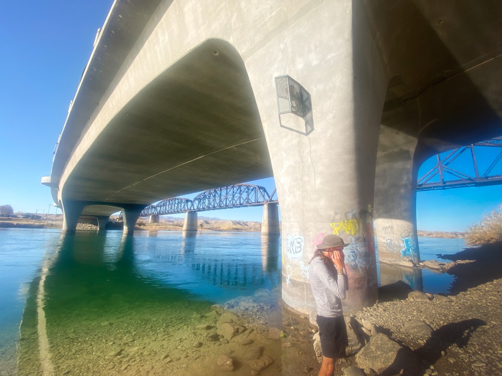
Looking at the maps, we could not find a clear way around this dam. We battled what to do for a bit before ultimately deciding to use Bluewater Casino and Resort. From here we had a 3 mile walk along a busy highway into Parker with no sidewalk, 3 miles had become a common theme in our walking distances.
Once center of town, we hit the gas station for more beers and a big ole Bomb Pop each. Fumbling with our heavy kayaks and their rigged carts in the AZ heat, we deserved it. Our Bomb Pops turned into a beers before making it to where the highway crosses over the Colorado.
We offroaded our kayaks down under the bridge, where there was a plethora of broken glass, graffiti and remnants of a camp. Definitely feeling a little out of place until we realized that WE were the degenerates drinking beer under a bridge. We shoved off, running out of light fast and needing a place to stay.
River gets fast and shallow here, we had to really focus on keeping our bow pointed down river. Don’t want to get tossed overboard!
After a few miles, we are nowhere near a place to call home for the night. At least as far as we can tell. On our left was a dirt road that runs along the river, which was perched about 5 feet above the water line. The surrounding area on that side of the river is what I’m assuming is sparse farmland, the tall bushes make it so we couldn’t really tell. We saw a spot where the dirt road dead ended and decided to hoist our kayaks up onto the road and camp at the end of it by the barrier.
A very challenging place to get out and even harder getting the kayaks up, we eventually succeeded right as the sun went down. We had done ~22 miles downriver today and had just set up our first questionable camping spot. Staring across the river into the backyards of people who were hanging out and undoubtably looking at us wondering what the hell we were doing.
Day 8: Feb 20th
Apparently, our neighbors were indeed chill, as we slept all night undisturbed. To increase our chances of avoiding any sort of officials, we got out of dodge before the sun was up.
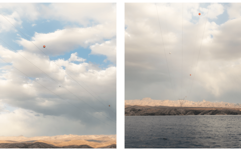
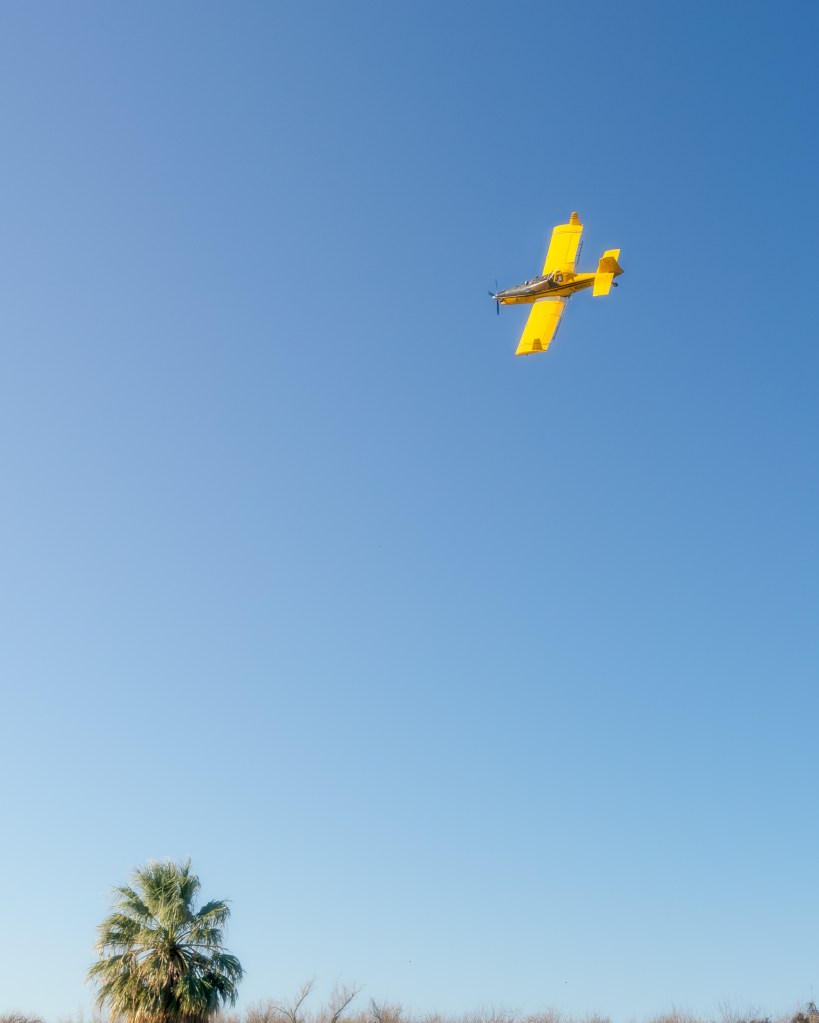
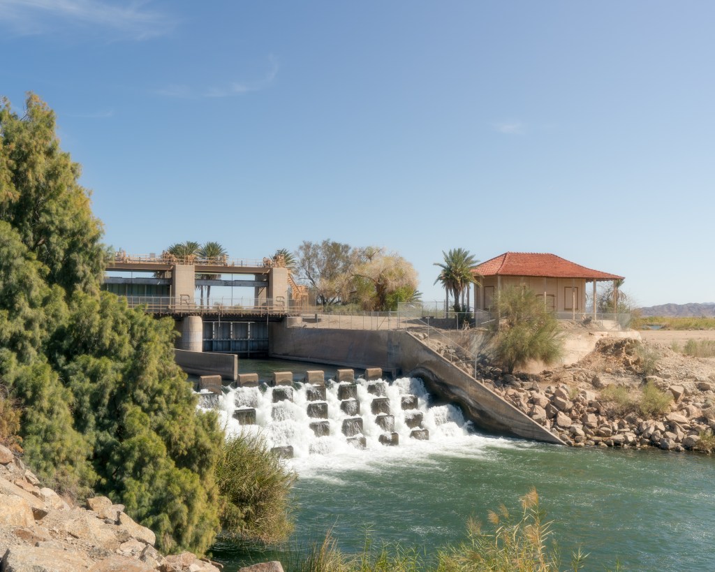
Another big day on the horizon, we had our 4th dam portage. This is a pretty uneventful section of river, farmlands essentially and nothing urban or naturally appealing. However, a crop pilot took notice of us and proceeded to give us an awesome airshow, complete with a flyover!

It was a nice break in the routine as we floated down river and the pilot kept getting closer to us. I shot this photo on my 16-35mm, to give you an idea of how close he got.
The wind started to pick up right as we were approaching Palo Verde Dam. This dam appeared to have no discernable path around either, so again we were prepared to improvise. This would be the most challenging portage thus far.
Our first goal was a little dirt road we could see on the map. We were on an Indian Reservation at this point and heading east. After a junction with another dirt road, we started heading south again towards the river.
The road started to curve back east and move away from the river, so at this point we turned our kayaks into offroad machines again and proceeded to pull them through about a foot of loose deep sand. IT WAS BRUTAL. This lasted until we found a mini sand dune area, situated about 20 feet above the edge of the river.
At this point, we were unsure of how to get our boats down to the water and we were pushing it on time. So, we decided we were going to risk it for the biscuit again with some stealth camping and figure it out in the morning. The small dunes were surrounded by tall shrubs, we actually felt decently hidden. Total river miles for the day were ~34 and kayak walking 2.
Day 9: Feb 21st
Waking up from what would be the coolest camp spot of them all, we had once again gone undetected. Now we just had to figure out how to get our boats down to the water. A feat that we undoubtably complicated trying to overthink and be extra safe.
We had to lower our kayaks down an extremely steep sand bank, scared we wouldn’t be able support our own kayaks weight alone, we tied our paracord to one kayak at a time. One person stayed up top holding the rope, while another slid down the slope supporting the kayak from the bottom until we got them in the water.
Some crazy wind had kicked up at this point, along with a bit of rain so we hurried on our way. Unfortunately, the wind got worse and shortly after starting we were cold and at a complete stand still on the water. We found a beach to park on and try to wait it out, as we were unable to push forward. The thought of camping there crossed our minds but the 40MPH gusts carrying grains of sand, essentially fusing the sand with every fiber of our clothes and orifice on our body, that became a last resort.
Having only gone about 6 miles, we really wanted to keep going. However, at this point we had received a severe storm warning and knew our day would be cut short. Looking at the map, the town of Blythe and Ehrenberg appeared to be about another 5 miles downriver. We now had a goal. Best Western of Ehrenberg.
Battling the wind and sand, playing the curves of the river and the wind in order to progress slowly but surely; we made it to a spot on the north side of town to take out. After taking out, we had another mile walk along a highway with no sidewalk.
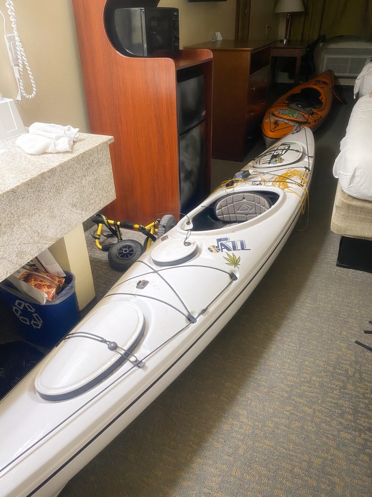
Still getting the sand out of our mouth and eyes, we made it to the greatest sight we have ever seen. Best Western. After paying $200 for a night and requesting a bottom floor room close to the door, we felt relief.
Our next worry was shortly followed though as we were contemplating what to do if we couldn’t get the kayaks into the room. Do they sell bike locks at the gas station? Does the hotel window open all the way? Can we pop the screen out if so?
We empty the kayaks and get our room ready to house two 13-foot kayaks. Giving it the ole college try; we get one inside the halls and start trying to turn it into the room. After quite a bit of banging, one person lowering their end to the floor while the other person lifts to the ceiling, while rotating the kayak and laughing off the stares of housekeeping, we finally got one in the room. Time do it again but this time with even more of an audience as we had drawn a crowd.
Only a total of about ~11 miles today, time to shower and relax.
Day 10: Feb 22nd
Waking up and checking the forecast, severe weather warning had gotten worse. A very dangerous sandstorm, advising everybody to shelter in place. We decided it better not get back on the river. Another $200 and we secured our second night at the hotel.

We ate Wendys, crappy gas station pizza, drank beer, watched The Revenant and just played on our phones all day. A nice little zero day for us.
Later that night, the wind finally started to calm down and we prepared to say goodbye to our luxury palace.
Day 11: Feb 23rd
Waking up early and walking our kayaks down to the water’s edge, we felt rejuvenated and ready to tackle the last stretch. Passing a transient camp before getting our kayaks into the water.
Our destination today was a spot called Walter Camp, located above Imperial National Wildlife Refuge. The weather this morning was overcast, a bit windy, rainy and cold. Luckily a few hours into the day and that turned around.
An uneventful but productive day, covering ~39 miles. Making it to Walters Camp, which is just a primitive spot off the side of the river. We set up in the rather dirty area and called it day. During the night, we kept hearing Wild Burros creeping closer. Their HEE-HAa’n keeping us up due to laughter.
Day 12: Feb 24th
We awoke to more Burros by our camp and frozen water, it had dropped below freezing during the night. It had been flirting with it the whole trip so far. After warming up a bit, we hit the water!
Our goal was Martinez Lake a place with a marina, campground and bar.
At this point, although gorgeous, everything was starting to look the same and my photo taking really took a back seat. The day before and today were pretty empty in those regards and anything I did take I wasn’t too impressed with.
Making it to Martinez Lake, we paid for camp spot, we walked our kayaks to the primitive camping area and prepared ourselves for a night of pizza and beer. Hard life, I know. We drank and mingled amongst the town folk. Total was around ~35 miles for the day.
Day 13: Feb 25th
More Burros waking us up at camp, they are everywhere out here. Quite the funny sight honestly. We got on the water at about the same time as all the fishermen, who zip in and out of the reeds and into their own little fishing holes like madmen. Fishing is life near Martinez Lake.
After a while we made it to Imperial Dam, which again would prove to be about 2 miles of kayak walking. It was okay though; we had a pep in our step at the possibility of today being the last day on the water.
After our walk through a trailer park, down a sidewalk-less highway, we had found another spot to put in and continue on our marry way. This time again, down a steep rocky embankment. We had completed our 5th dam portage.
About 7 or 8 miles later, we were approaching Laguna Dam, our final boss. Again, this dam required highway walking with no sidewalk. Only about a mile and a half before we had found a way back down to the river below and we could smell victory.
Once we got back to the water’s edge, I dawned my rattlesnake covered short sleeve button-down just make sure the vibes were immaculate for the big finish.
It’s also worth noting that after every dam, the water gets shallower, skinnier and faster. At this point the mighty Colorado isn’t so mighty and it’s a ghostly remnant of its former self.
We rubbed bellies in the shallow waters the next few miles before it eventually opens back up a bit and starts becoming more and more urban as you approach Yuma, AZ.
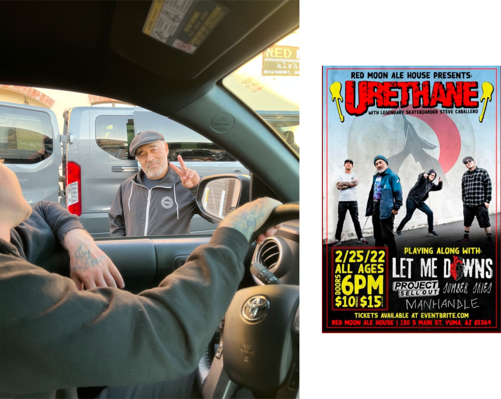
My parents had swooped up my truck on the way down to meet us in Yuma, all that was left was to load up the kayaks, grab some food and drive home. However, we were in for one more surprise.

We decided to all go eat at Red Moon Ale House, a spot randomly picked because it was close and had everything we were looking for. As we pulled into the parking lot, we see pro skateboarder and absolute legend, Steve Caballero. Who I had met a handful of times throughout my career at Vans. He was playing a show with his band Urethane at, you guessed it, Red Moon Ale House.
After drinking some beers, eating some food and watching the live show, it was finally time to make our way home. Also time for me to get into the dentist.
Over ~330 river miles, 13 days, ~10 miles walking our kayaks, 6 dam portages, ~3 miles just walking, a broken tooth and a trip we will never forget.
Special thanks to Brian for joining me on this wild adventure and to everyone we met that was hospitable and encouraging.
-Andy
